


DJI Mavic 3 Enterprise RTK Module – Precision Mapping and Enhanced Accuracy
In the world of professional drone operations, precision isn't a luxury—it's a necessity. The DJI Mavic 3 Enterprise RTK Module is a game-changer for industries that rely on accurate data and reliable positioning.
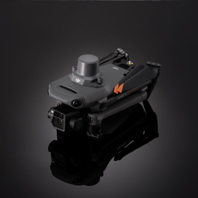
Designed exclusively for the DJI Mavic 3 Enterprise Series, including the Mavic 3E and Mavic 3T, this module delivers unmatched accuracy through Real-Time Kinematic (RTK) technology. Whether you’re conducting detailed topographic mapping, agricultural planning, or critical infrastructure inspections, the RTK Module ensures your data is as precise as your ambitions demand.
By enhancing GPS data with dual-frequency multi-mode signals and reducing the impact of atmospheric and magnetic interferences, this module sets a new standard for accuracy and reliability. Combined with tools like the D-RTK 2 High Precision GNSS Mobile Station or a custom Network RTK setup, the Mavic 3 RTK Module becomes a cornerstone of efficient, data-driven operations across multiple industries.
Advanced Positioning Technology
The RTK Module doesn’t just enhance GPS data; it transforms it. By leveraging real-time corrections from fixed ground stations, the module mitigates geographical errors caused by atmospheric interference and magnetic distortions. Its compatibility with the D-RTK 2 High Precision GNSS Mobile Station or a custom Network RTK further enhances its accuracy, making it an indispensable tool for precision-critical applications.
Features That Define Excellence:
- Centimeter-Level Accuracy: Essential for projects requiring precise positioning, such as engineering surveys, construction mapping, and geological assessments.
- Time Optimization: Speeds up workflows by reducing the need for ground control points and extensive post-processing, significantly cutting project timelines.
- Energy Efficiency: Designed for low power consumption without compromising performance, ensuring extended operational periods.
- Compact Design: With dimensions of 50.2×40.2×66.2 mm and a lightweight profile of just 24g, it integrates seamlessly into your drone setup.
- Versatile Applications: From agriculture to infrastructure inspection, this module ensures accuracy and reliability across diverse industry needs.
Seamless Installation and Usage
The DJI Mavic 3 RTK Module is engineered for effortless integration and operation.
Installation Made Simple
- Power off the drone and remove the PSDK port cover on the top of the aircraft.
- Attach the RTK module securely to the PSDK port.
- Tighten the knobs on both sides to ensure a firm connection.
Enabling RTK Functionality
- Activate RTK in the DJI Pilot 2 app by selecting the RTK service type (D-RTK 2 Mobile Station or Network RTK).
- Disable the RTK function when not in use to allow standard takeoff.
Setting Up D-RTK 2 Mobile Station
- Follow the D-RTK 2 User Guide for setup and linking.
- Power on the D-RTK 2 Mobile Station and switch to Broadcast mode.
- Connect via the DJI Pilot 2 app until the system achieves FIX status, indicating reliable differential data usage.
Using Custom Network RTK
- Ensure the remote controller is connected to the internet.
- Input necessary NTRIP server details in the app and save.
- Wait for the FIX status to confirm successful connection.
Industry Applications: Precision Where It Matters Most
Construction and Engineering: The RTK Module is invaluable for creating precise maps and monitoring construction progress. Its accuracy eliminates guesswork, enabling efficient site planning and resource allocation.
Agriculture: Optimize precision farming activities such as field mapping, crop monitoring, and irrigation analysis. The RTK Module provides actionable insights that boost productivity and sustainability.
Environmental Monitoring: From coastline mapping to forest management, the RTK Module aids in environmental conservation and pollution tracking, ensuring detailed and accurate data for informed decision-making.
Infrastructure Inspections: Conduct thorough inspections of bridges, railways, and other critical structures. The RTK Module ensures high precision, enhancing the safety and reliability of your inspections.
Operating Tips for Optimal Performance
- Use the RTK Module in open areas free from obstructions like buildings or dense foliage.
- Avoid blocking the module during operations for uninterrupted positioning accuracy.
- Always ensure the module and drone firmware are updated for the best performance.
Why Choose DSLRPros?
At DSLRPros, we combine expertise and efficiency to provide you with the tools you need for success:
- Expert Guidance: Our team ensures you select the right equipment for your specific needs, from drones to accessories.
- Reliable Shipping: We prioritize fast, dependable delivery so you can stay on schedule.
- Authorized Dealer: As a certified reseller, we guarantee genuine products backed by manufacturer warranties.
Unlock the potential of precision mapping with the DJI Mavic 3 Enterprise RTK Module. Transform your operations today by exploring our comprehensive range of drone accessories at DSLRPros.
Specifications
-
Positioning Accuracy: Offers horizontal accuracy of 1 cm + 1 ppm and vertical accuracy of 1.5 cm + 1 ppm.
-
Supported Systems and Frequencies:
-
-
GPS (L1C/A, L2C/L2P)
-
BDS (B1I, B2I)
-
GLONASS (G1, G2)
-
Galileo (E1, E5b)
-
QZSS (L1, L2)
-
-
Compatibility: Seamlessly integrates with DJI Mavic 3 Enterprise drones.
-
Data Integration: Capable of real-time data processing and compatibility with various GIS software.

