


Inspired Flight IF800 Blue Herelink Base Bundle - Unmatched Performance and Portability
The Inspired Flight IF800 Blue Herelink Base Bundle is built for portability and ease of use. Its lightweight, compact, and foldable frame makes it perfect for professionals on the go. Whether you're conducting infrastructure inspections, terrain mapping, or LiDAR surveys, this drone's rugged design ensures it can be easily transported and deployed in any environment. The specially designed case has ample space for all necessary components, including batteries and payloads, protecting them during transit.
Impressive Flight Time and Payload Capacity
Achieve maximum efficiency with an extended flight time of up to 54 minutes and a payload capacity of 6.6 lbs. The dual hot-swappable smart batteries allow for continuous flight operations without downtime. With a maximum speed of 49 mph, the IF800 Blue Herelink offers swift, smooth operations while maintaining stable flight, even in wind speeds up to 23 knots.
Advanced Features for Enhanced Control
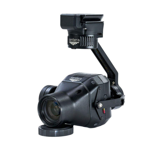
Equipped with advanced capabilities, the IF800 Blue Herelink features 30-degree upward-angle shooting, perfect for capturing data from new perspectives. Its FPV (First-Person View) camera enables real-time visual feedback, ensuring precise control during flight. Additionally, the bundle comes with the Blue Herelink controller, which is NDAA compliant and features a signal transmission range of up to 20KM, ensuring long-range performance and video/audio signal clarity.
Committed to Security and Compliance
The IF800 Blue Herelink is proudly made in the U.S., with no reliance on foreign technologies restricted by the National Defense Authorization Act (NDAA). This commitment to security makes it an ideal solution for government and commercial agencies that require reliable, high-performance drones for sensitive operations.
Explore the Inspired Flight IF800 Blue Herelink Base Bundle at DSLRPros today and take your aerial capabilities to the next level!
Redefine Professional Aerial Missions
Engineered for professionals, the IF800 Tomcat sets a new standard for heavy-lift drones, combining adaptability, durability, and advanced technology. Designed to excel in demanding environments, this robust platform ensures accuracy and dependability in every operation.
Unmatched Payload Capability for Specialized Tools
- Exceptional lift capacity enables seamless integration of high-performance sensors, cameras, and equipment.
- Ideal for capturing detailed aerial maps, conducting industrial inspections, or monitoring environmental conditions.
- Built to handle sophisticated tools for advanced data collection.
Adaptable Design for Custom Configurations
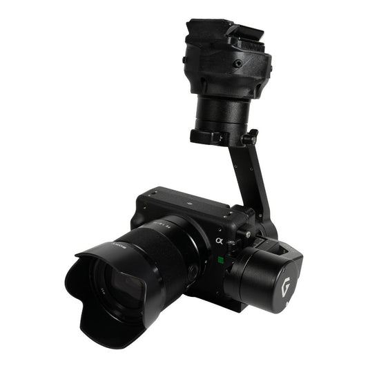
- Modular payload system supports quick and easy integration of various technologies.
- Compatible with high-resolution cameras, thermal imaging systems, and LiDAR sensors.
- Flexible design makes it a valuable asset across multiple industries.
Accurate Navigation for Critical Tasks
- Equipped with cutting-edge RTK GPS systems for highly accurate and stable flight paths.
- Essential for tasks such as land surveys, infrastructure evaluations, and urban planning.
- Delivers precision even in challenging conditions.
Built Tough for Extreme Environments
- Constructed with industrial-grade materials for reliability in harsh conditions.
- Ensures durability and consistent performance during high-stakes missions.
- Provides peace of mind with rugged construction built for extremes.
Maximize Impact Across Multiple Industries
Geospatial Data CollectionCapture detailed data for surveying and mapping projects with unparalleled accuracy. The IF800's ability to integrate advanced sensors streamlines workflows for construction, urban development, and land management professionals.
Infrastructure AssessmentFrom power lines to wind turbines, the IF800 delivers precise imaging and real-time data for proactive maintenance. Its ability to carry multiple sensor types ensures thorough inspections to identify potential issues before they escalate.
Agricultural InsightsMonitor expansive fields and forested areas with ease. Equipped with multispectral imaging, the IF800 provides actionable insights into crop health, irrigation systems, and forest management to optimize resources and enhance productivity.
Emergency Response SupportEquip first responders with reliable aerial tools for search and rescue operations. The IF800's stability, extended flight time, and high-resolution imaging make it an essential resource for quickly covering large areas and assessing disaster zones.
The Ultimate Aerial Solution for Industry Leaders
The IF800 Tomcat offers unparalleled versatility, accuracy, and durability, making it the go-to choice for professionals across a variety of sectors. Trust in its capabilities to enhance your operations and achieve superior results.
Elevate your missions today with the IF800 Tomcat.
Why Trust DSLRPros?
DSLRPros is dedicated to equipping industries with innovative drone solutions.
- Industry-Focused Tools: Tailored drones for diverse sectors.
- Strategic Expertise: Solving unique challenges with precision.
- Reliable Equipment: Featuring trusted drones like DJI Phantom.
- Secure Data Handling: GDPR-compliant systems for safe workflows.
- Comprehensive Training: Support to maximize operational efficiency.
We deliver the tools and knowledge you need to thrive.
Specifications
Performance
- Max Ascent Speed: 5 m/s (16 ft/s)
- Max Descent Speed: 3 m/s (10 ft/s)
- Max Air Speed: 22 m/s (49 mph)
- Max Wind Resistance: 10 m/s, 12 m/s gusts (19 knots, 23 knot gusts)
- Max Tilt Angle: 30°
- Max Angular Velocity: Tilt: 300°/s, Yaw: 120°/s
- Operating Temperature: -20°C ~ 45°C (-4°F ~ 113°F)
- Operating Humidity: IP43 5% ~ 99%
Physical Features
- Diagonal Size (propeller center to center): 905 mm (35.6 inches)
- Unfolded Size (flight ready, WxLxH): 132 x 114 x 52 cm (51.8 x 44.8 x 20.3 inches)
- Folded Size (stow, WxLxH): 36 x 44 x 20 cm (14.2 x 17.4 x 7.8 inches)
- Empty Weight (w/o batteries): 4.2 kg (9.2 lbs)
- Weight w/ Batteries: 8.5 kg (18.7 lbs)
- Max Gross Takeoff Weight: 11.5 kg (25.3 lbs)
- Max Payload Capacity: 3.0 kg (6.6 lbs)
- Transport Case Size (WxLxH): 52.8 x 80.7 x 31.7 cm (20.8 x 31.8 x 12.5 inches)
- Transport Case Weight (w/ aircraft & GCS): 18 kg (40 lbs)
Flight Stack
- Flight Controller: CubePilot Cube Blue H7, Triple Redundant IMU
- GNSS / Compass: Dual CubePilot Here4 Blue
- Downward Ground Sensor: LightWare SF000/B
- Payload Power Rails: 6s Battery Voltage 5v, 12v, 18v
- Payload Interface: IF800 Universal Payload Interface
- Operating Software: Copter by Ardupilot
Flight Modes
- Position Hold: Automatically holds altitude and position, manually change position
- Loiter: Holds altitude and position, precision manual movements using GPS
- Auto: Executes pre-defined waypoint mission
- RTL: Auto returns to takeoff location and lands
- Land: Auto land while maintaining horizontal position
- Altitude Hold: Holds altitude only, failsafe mode if GPS signal lost
In the Box
- 1x Inspired Flight IF800 Aircraft
- 1x Blue Herelink Ground Controller
- 1x Rugged Transport Case
- 2x Batteries
- 1x Charger

